Nautical Software .com
Order Now : 020 8405 8200
GPS Navigation Tutorial
The Route to Better GPS Navigation at Sea
GLOBAL POSITIONING SYSTEM - LEARN TO GET THE BEST RESULTS
Software to teach better GPS use. Learn to Navigate more effectively, using the right information from the GPS receiver. Learn basic chartwork techniques which can give faster, more accurate navigation, using your GPS instrument.
Learn How the Global Positioning System Works
The GPS Tutor explains, in a non-technical manner, how GPS can tell you your position with incredible accuracy, anywhere in the world. Animations and explanations help you understand how it works and what GPS can do for you.
GPS Controls and Displays
All GPS instruments differ from each other, and all share many similarities. See what controls and displays are available and which should you use in any particular situation. Quick, accurate navigation depends on using your GPS equipment correctly.
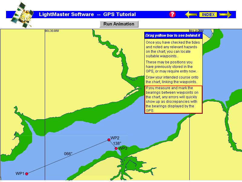
GPS and Navigation Charts
Unlike car navigation systems, which know every road and can calculate the shortest route to drive, on boats you must use the GPS with a nautical chart. Whether you use a paper chart, or electronic chart plotter, you cannot navigate safely with the information on the chart. You must tell the GPS set the route you wish to follow, it cannot decide for itself. The GPS Tutorial illustrates the dangers which face the unwary.
Installing & Initialising a GPS Receiver
Learn the correct methods for installing GPS on your boat, how to interface GPS with computers and other instruments, and how to perform the initialisation when you first run the GPS set. Choose the right datum and units of measurement, or you will receive inaccurate or confusing data.
Passage Planning and Boat Safety
Passage Planning is a legal requirement, and an essential skill in navigation. A full module of the GPS Navigation Tutor is dedicated to safety and passage planning. Novice boaters should pay particular attention to the lessons on safety equipment and planning your trip, even if you are simply cruising around near your home port. Learn the importance of checking the tides: using predictions of tidal heights and tidal streams. Basic tidal prediction and passage planning software is described.
GPS Accuracy – DGPS, EGNOS and WAAS
The potential accuracy of the Global Positioning System is staggering, but can you rely on it? Learn how most GPS receivers can accept additional signals to improve accuracy and check the integrity of the system. How will the European Galileo satnav system compare, compete or supplement the existing USA owned GPS system? How does accuracy vary with the number and position of the satellites from which you receive signals?
Acronyms Decoded
Technology introduces hundreds of acronyms and a minefield of jargon. The GPS Tutorial cuts through the babble to explain in simple terms and uses illustrations and animations to bring clarity.
Interactive Software
Unlike video DVDs, you interact directly with the software in these programs. Not only can you start, stop and change chapters at will, the simulated GPS display screens reflect what you options choose and where you move your vessel. The more actively involved you are with the program, the more you learn and remember.
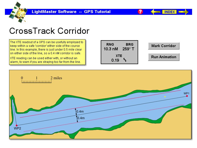
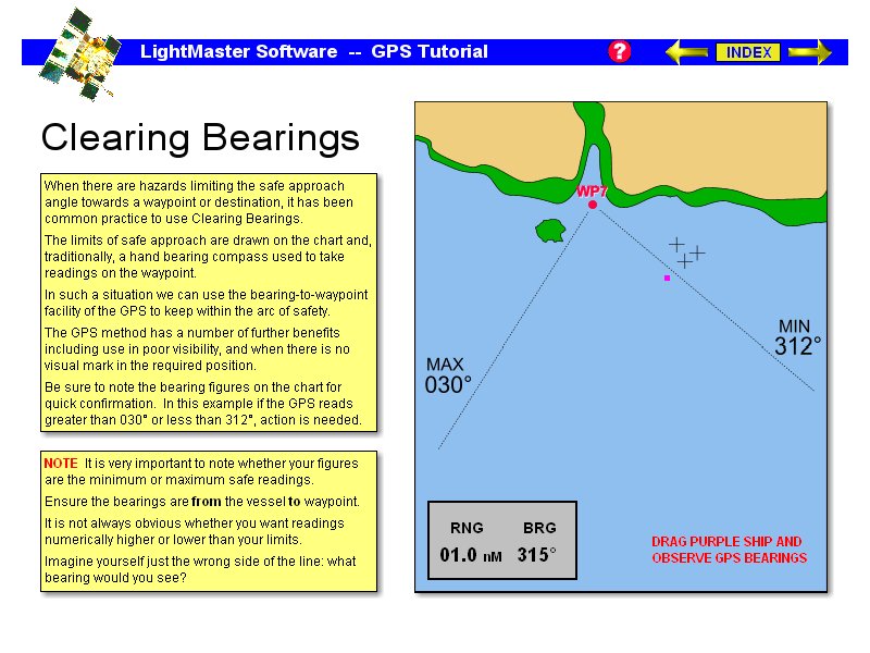
GPS Chartwork Techniques and Tips
Improve your navigation by adopting the many chartwork ideas presented in the Tutorial. Simple pre-planning techniques, used by professional navigators, help you take the right decision more quickly.
PC Requirements to Run the GPS Tutorial
- Windows™ 7, 10, or 11
- 20Mb Hard Drive Space
- 1Gb RAM
- Loudspeaker or headphones - for animation sound effects
- Internet Connection or USB socket - for program installation